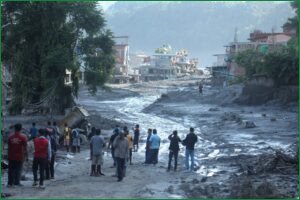
In the wake of a devastating flash flood that struck Nepal on August 26, 2026, a fierce debate has emerged over the disaster's massive death toll and the efficacy of early warning systems. The disaster, which caused massive damage along the Bhotekoshi River in Nuwakot, has sparked grief and anger across the region, raising serious questions about how such a high casualty rate occurred.
Three weeks after the disaster, the scale of the tragedy continues to grow. Authorities in Nepal have revised the death toll upward, with more than 1,400 bodies recovered and an estimated 6,000 people still missing on the Nepali side alone. In neighboring Tibet, dozens more are reported dead or missing. Furthermore, the threat has not fully subsided, as both governments report that a barrier lake remains at the collapse site, raising fears of a potential second flood.
The disaster quickly triggered a divide on Nepali social media. One faction blamed the Chinese government, alleging that a failure to share satellite and disaster monitoring data cost lives by depriving Nepal of precious minutes of warning. The Chinese Embassy in Kathmandu strongly rejected these claims as "completely false and misleading," asserting that Beijing shared information with Nepal in a timely manner. This defense was echoed by Nepal’s own National Disaster Risk Reduction and Management Authority (NDRRMA), which pushed back against the narrative blaming Beijing. Survivors and local officials also noted that while warnings did eventually reach them, the sheer speed of the flood left virtually no time to escape.
A technical reconstruction published by researchers from the Chinese Academy of Sciences’ Institute of Mountain Hazards and Environment supports this timeline of rapid destruction. Scientists determined that a glacier on the southern slope of Langtang Lirung, situated at an elevation of about 5,200 meters, fractured at 10:52 a.m. China time (8:47 a.m. in Nepal). The collapse triggered an ice-rock avalanche that transformed into a debris flow, covering 22 kilometers to reach Gyirong Port on the Chinese border in approximately seven minutes. Traveling at an average speed of nearly 50 meters per second, the debris moved too quickly for any advance warning to be actionable. Su Pengcheng, a researcher at the Chinese Academy of Sciences, explained that the collapse was caused by long-term glacier instability driven by climate warming, rather than a trackable weather pattern.
Beyond the immediate finger-pointing, the disaster has exposed deeper vulnerabilities in Nepal’s disaster response capabilities. Experts point out that Nepal remains heavily dependent on foreign satellite and monitoring infrastructure, as it does not own any such systems itself. As one of the world's most disaster-exposed regions, the country faces critical questions about its sovereign monitoring capacity. Without independent real-time tracking systems, Nepal remains vulnerable to future Himalayan hazards where satellite data forms the backbone of life-saving flood and cyclone alerts.
You have reached the limit of 2 free articles this month.
Arguments over who knew what and when still continue, but the ongoing debate is hiding harder questions: can Nepal actually monitor hazards like this in real time on its own terms? Or does it keep failing at early warning in disaster after disaster because Nepal depends on satellite and monitoring infrastructure – none of which Nepal owns itself?