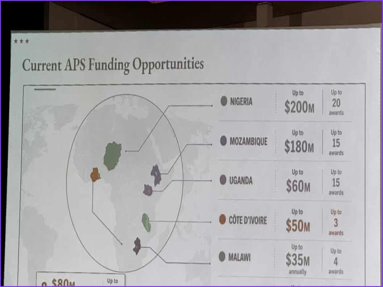
The US State Department has issued an apology after a presentation at the Aids 2026 conference in Rio de Janeiro featured a map that incorrectly labeled every country in Africa. The error occurred during a session regarding the department's latest health agreements, where the map was displayed midway through the presentation given by Jeff Graham, the top US health envoy overseeing the President’s Emergency Plan for Aids Relief (Pepfar).
Video footage of the event, reviewed by Reuters, shows significant geographical inaccuracies. Nigeria, a nation where the US currently has several hundred troops deployed, was depicted as landlocked within the Sahara desert. Additionally, Mozambique was erroneously placed in the Horn of Africa, while Côte d’Ivoire was moved to the opposite side of the continent. A technical analysis of the map image revealed an artificial intelligence watermark, suggesting it was generated using OpenAI tools; the company has stated it is currently investigating the matter.
The department acknowledged that the slide deck had been modified in a rush by a team member shortly before the event. In an official statement, the State Department expressed that it takes “full responsibility” for the confusion and misrepresentation caused to attendees, particularly its African partners. Despite the incident, the agency maintained that the conference discussions remained “substantive and constructive” and reaffirmed its commitment to the global fight against Aids.
The map’s appearance sparked immediate criticism online after screenshots were shared on LinkedIn and in a Substack post by Aids expert Emily Bass. Matt Petit, an expert on AI and geopolitics at the Atlantic Council, criticized the oversight, noting that the creators appeared to lack basic geographical knowledge. While Pepfar’s essential work, such as the distribution of life-saving medication, has largely resumed following a period of funding uncertainty under the Trump administration, the US is currently scaling back other initiatives, including prevention and surveillance efforts, and intends to phase out the program entirely in South Africa.
Screenshots of the map first appeared in a Substack post by the Aids expert Emily Bass and were widely shared on LinkedIn, with one post garnering about 40,000 views.