
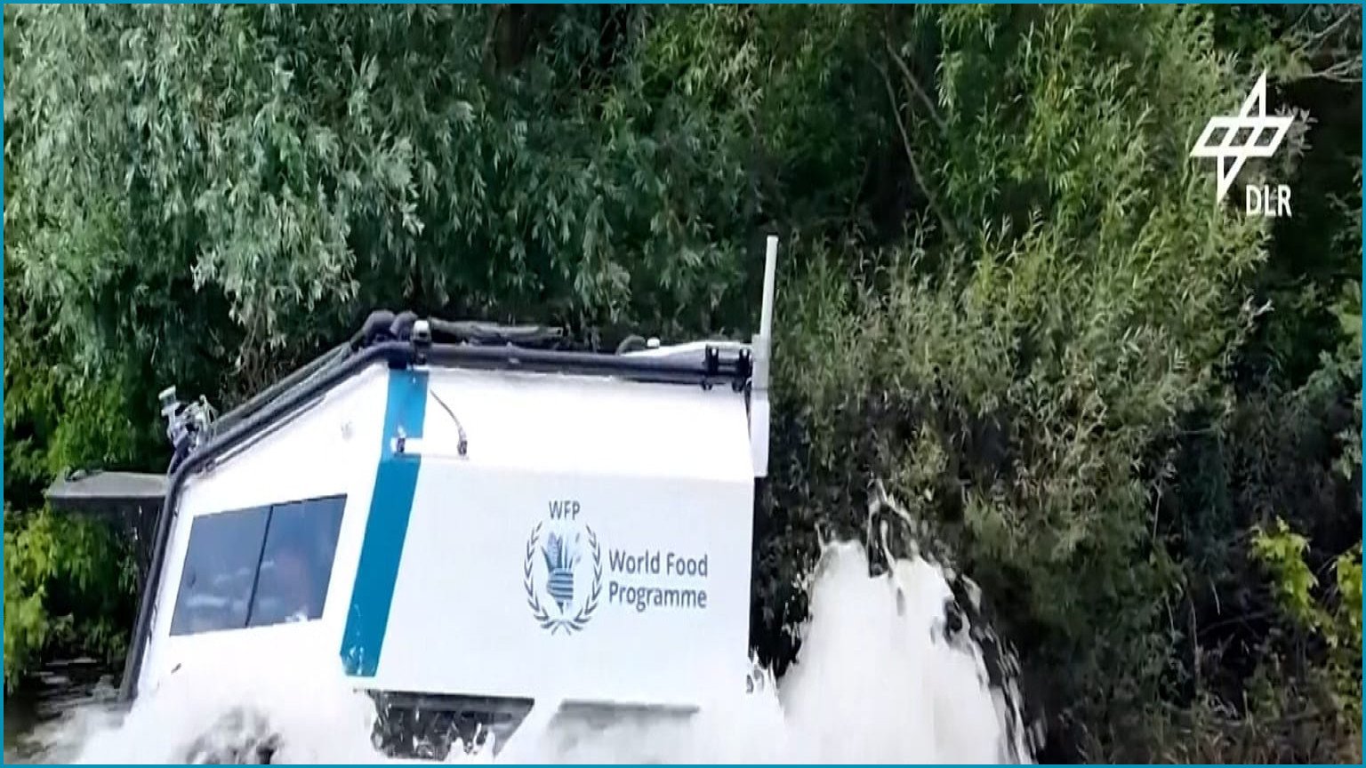
Humanitarian organizations are increasingly turning to advanced technology to mitigate the risks faced by aid workers. Delivering food through conflict zones, minefields and floods can put humanitarian workers at mortal risk. A primary initiative in this field is Project AHEAD, a collaborative effort involving the World Food Programme, Germany’s aerospace research centre DLR, the Red Cross, and various technology partners.
This project focuses on developing remotely operated vehicles designed to transport essential supplies through terrain deemed too hazardous for traditional delivery trucks.
Testing conducted at a DLR site in Germany has demonstrated the capabilities of the SHERP all-terrain vehicle, which can navigate open water and traverse rough landscape. By utilizing onboard sensors to scan the path ahead, these vehicles can be operated remotely, eliminating the need for a driver to be physically present.
The system leverages DLR’s extensive expertise in planetary rovers, including the technology developed for the MMX mission to explore Phobos, a moon of Mars.
Beyond physical delivery, artificial intelligence is also being utilized to monitor global food security. The World Food Programme’s HungerMap Live platform employs machine learning and near-real-time data to track food insecurity across more than 95 countries. According to Bernhard Kowatsch, director of the WFP’s Global Accelerator and Ventures division, the platform integrates data on conflict, weather, climate hazards, and economic conditions to identify emerging crises.
The tool is publicly accessible and is currently being enhanced to forecast food security trends up to 90 days into the future.
Mapping data remains a critical component of humanitarian logistics, as aid workers require precise information on infrastructure and population centers to coordinate evacuations and shelter placement. Following the two powerful earthquakes in northern Venezuela this June, the Humanitarian OpenStreetMap Team utilized machine learning to identify damaged buildings from satellite imagery.
This data was then verified by over 600 volunteers through the MapSwipe app, who categorized the extent of structural damage within four days. Leen D’hondt, director of technology and data at the Humanitarian OpenStreetMap Team, noted that this rapid mobilization allowed early responders to prioritize food and emergency aid delivery effectively.
Despite these advancements, experts caution that AI is not a replacement for human precision. D’hondt emphasized that while manual mapping offers higher quality, AI provides essential speed. “Sometimes it’s more important to know more or less where the buildings are. They’re not perfectly mapped, but we know how many people are living in that area.
And that’s where AI and machine-learning models come into the picture right now.” Furthermore, the integration of these systems into global emergency protocols remains in the early stages.
Monique Kuglitsch, innovation manager at the Fraunhofer Heinrich Hertz Institute, observed that while operational AI-based early-warning systems exist in places like India and within European meteorological centers, such technologies are still largely experimental in most regions of the world.